Learning intention: We are learning to interpret information contained in maps.
AT Look for’s: I can use a simple scale to determine a distance between features of a map. I can use directions to find features on a map I can use a Legend to identify features on a map
Which One Doesn’t Belong? Why?
Introduction to Maps
Where is the sun?
- Put a street map of the area on the board. Ask the children to say what they can see and what they already know about maps.
- Read aloud a poem about cardinal directions.
- Engage students by reading aloud the poem “Geese on the Go” on the handout. https://media.nationalgeographic.org/assets/file/Cardinal_Directions_Poetry.pdf
- Beforehand, ask students to listen for directional words. Ask them to raise their hands when they hear one. You can also give students a copy of the handout or project the poem. Invite the class to read aloud the last two lines of each verse in response to the question in the first two lines, which you will read.
Where is the sun?
- Sit in a circle outside. Ask students » Where’s the sun? » What direction is the sun? » Which way is north?
- Use an object, such as a branch, to depict north. Explain the other cardinal directions and use a mnemonic device to aid students’ memory, such as the sentence “Never Eat Soggy Weetbix.”
- Ask students to use materials in the area to mark the other directions.
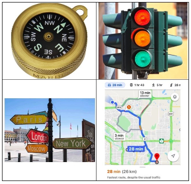
- Explain what a compass is and how it functions.
- Use a compass to test the accuracy of where students placed objects to mark directions in step 3.
- Make any needed corrections
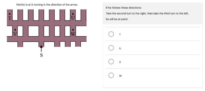
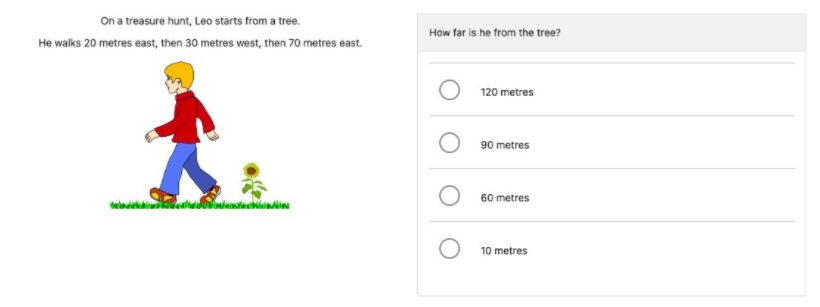
Word Problem Mapping- Practise the GA problem solving model to break down either of these problems (taken from Yr.5 Pat M test).
Have you ever used a map? Some people use maps to guide them to unfamiliar places, and some people use them to learn about faraway lands; but maps are smaller versions of the real thing. Imagine if you unfolded a map of your hometown and it was as big as the town itself! It would be virtually unusable. That's why cartographers, or people who make maps, use map scale. Maps are drawn to scale which means that if you made it bigger or smaller it would look exactly the same.
SCALE
Map scale is the relationship between distance on the map and distance in real life. That means that distance on the map always has a constant ratio with distance on the ground. For instance, a map scale might say that 1 cm is equal to 1 km, so if you measured from one point to another and it was 2 cm on the map, it would be 2 km in real life.
Other resources
Envision 6.1, 6.2, 6.3
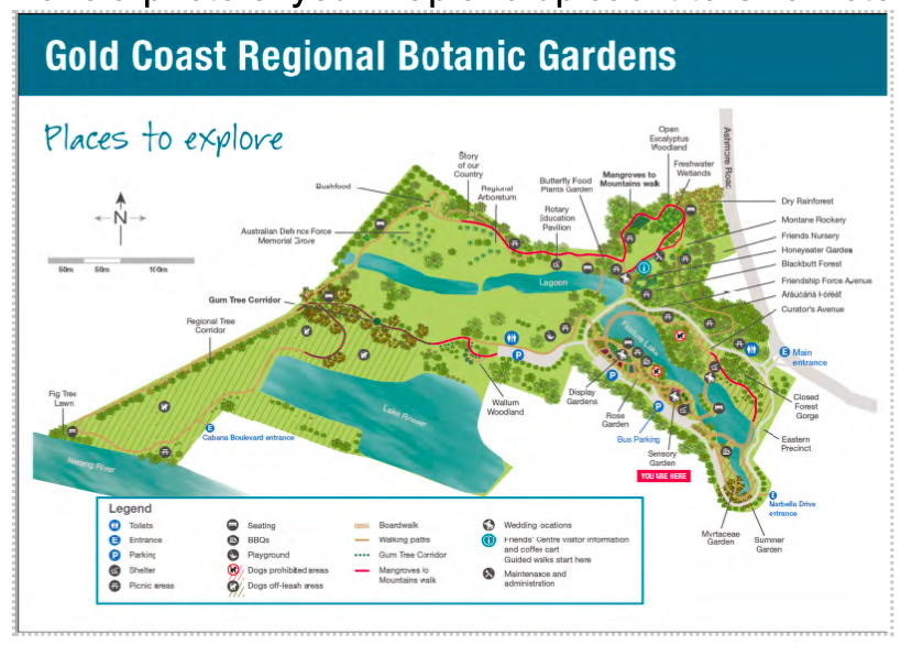
ASSESSMENT: Map of Gold Coast Botanical Gardens- Refer to map in Resources.
Envision 6.1, 6.2, 6.3
- Using a grid map https://www.scootle.edu.au/ec/viewing/L350/index.html
- Using a compass map https://www.scootle.edu.au/ec/viewing/L351/index.html
- Make a walking track https://www.scootle.edu.au/ec/viewing/L352/index.html
ASSESSMENT: Map of Gold Coast Botanical Gardens- Refer to map in Resources.
- Have the children use the map of Gold Coast Botanical Gardens finding places using directions. Have them find the quickest way to a location and what can be seen from a different location.